2023-2024 USAP Field Season
Project Detail Project TitleCollaborative research: Site survey for subglacial bedrock exposure dating at the margin of the Wilkes Basin in northern Victoria Land Summary
Event Number:
Program Director:
ASC POC/Implementer: Principal Investigator(s)
Dr. Gregory Balco
Location
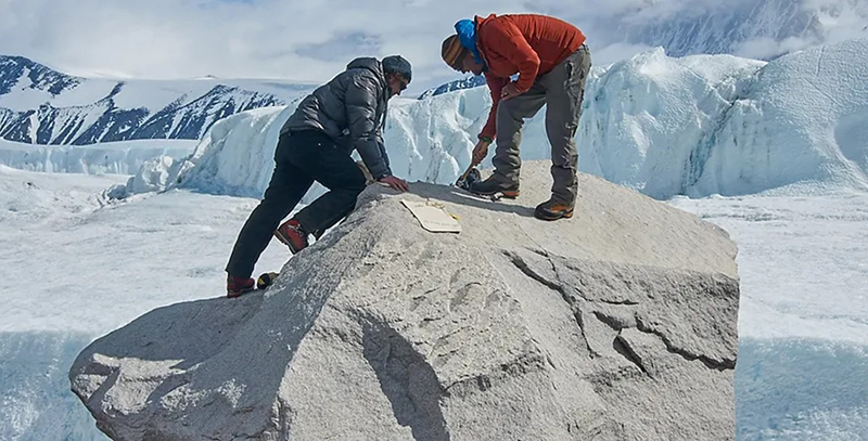
Supporting Stations: McMurdo Station DescriptionThe goal of this project is to establish, through direct geological evidence, whether complete deglaciation of East Antarctic marine basins took place during past warm-climate periods. Direct geological information about whether or not the Antarctic Ice Sheet responded catastrophically to past climate changes is important to evaluating the likelihood of significant ice-sheet response to future climate change. The team will assess the feasibility of achieving this goal using cosmogenic-nuclide measurements on bedrock that is currently buried under the ice sheet. They will conduct a reconnaissance and site survey to identify drill sites where subglacial bedrock-exposure dating could be used to test whether ice at those sites was absent when the Earth last experienced current levels of carbon dioxide—at approximately 3 to 3.3 million years ago.
Field Season OverviewThis single field season (2023-24) reconnaissance and site survey is designed to identify drill sites for a future proposal that would utilize the Agile Sub-Ice Geological (ASIG) drill for sub-glacial bedrock sampling. Six participants, including a mountaineer, will spend four weeks working at several sites in the western Outback Nunatacks region of northern Victoria Land, conducting snowmobile-towed radar surveys, geologic mapping, and rock/sediment sampling. The team’s mountaineer will clear each study site in turn, and the entire field team will complete work at that study site prior to moving to the next. The team will access study areas from a central field camp by snowmobile traverses of up to 40 km. Deploying Team Members
|
2023-2024 Science Planning Summary

For USAP Participants |
For The Public |
For Researchers and EducatorsContact UsU.S. National Science FoundationOffice of Polar Programs Geosciences Directorate Randolph Building 401 Dulany Street Alexandria, VA 22314 Sign up for the NSF Office of Polar Programs newsletter and events. Feedback Form |

: Wilkes Basin in northern Victoria Land")
